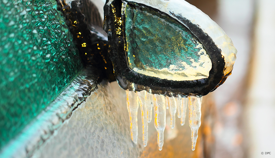
The approach of El Niño raises fears of another episode of freezing rain like the great ice storm of 1998.
Fortunately, through research projects such as that of Julie Thériault, an atmospheric science researcher at Université du Québec à Montréal, meteorologists now have better tools for predicting freezing precipitation, which will ultimately help people to prepare better for extreme winter weather events.
The phenomenon is well understood, but most climate models are not able to predict freezing rain events.
Freezing rain is formed when a thick layer of warm air lies above a shallow layer of cold air. Snow crystals passing through the warm upper layer melt into rain, which is supercooled by the cold air and turns into ice at the earth's surface. The phenomenon is well understood, but most climate models are not able to predict freezing rain events, which are largely controlled by microphysical processes. For example, when the temperature hovers around 0 ⁰C, local winds can act as a meteorological switch between snow, ice pellets and rain by heating or cooling the local environment.
Julie Thériault has demonstrated scientifically that the heat exchange from melting snow can cause valley winds to change direction. The change in wind direction can then result in snow changing to rain. These processes contribute significantly to the formation of freezing rain and ice pellets in the St. Lawrence River Valley, a region whose topographical features cause wind to be channelled near the earth's surface. Julie Thériault is studying these small-scale interactions in order to help meteorological models to anticipate phase changes in precipitation during winter storms characterized by temperatures around the freezing point. In short, better forecasts will allow for better planning!

La forêt boréale et les changements climatiques
Mieux comprendre l’autisme grâce au cholestérol cérébral
